

Position in the Caribbean
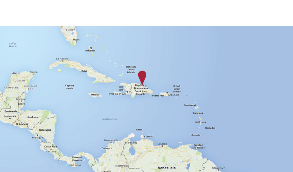
Authentic paradise on earth, thanks to its splendid picturesque beaches, the Caribbean region encompasses the Antilles and the countries, the coasts of which are washed by the Caribbean Sea, from Belize to Venezuela. The island named Hispaniola is the second largest in the Antilles, after Cuba. Its surface covers 48.442 km2. The country has only one terrestrial frontier with the Republic of Haiti on the west side, its north coast is washed by the Atlantic Ocean, and the south one – by the Caribbean Sea; the Mona Channel separates the Dominican Republic from Puerto Rico.
The Dominican territory is mostly mountainous, dominated by Cordillera Central, with the highest pike in the Caribbean, the Pico Duarte, reaching the height of 3,087 m, where the temperature may drop down to as low as zero. Other mountainous chains are Cordillera Septentrional or Sierra de Monte Cristi, Cordillera Oriental, Sierra de Yamasá, Sierra de Samaná, Sierra de Baoruco, Sierra de Neyba and Sierra Martín García. The climate is tropical Caribbean, with abundant rains and obvious climatic zones depending on the altitude. Medium annual temperatures fluctuate between 15°C and the maximum normal temperature reaching 40°C in protected valleys, during the hottest periods.
Position on the Island
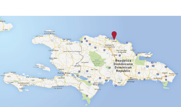
The residence “The Green Hills Village“ will be built on the north coast of the Hispaniola island. The climate here is tropical-maritime, with slight seasonal temperature variations. Medium daytime temperature varies between approx. 25°C in January to 35°C in July. The period from June to October is the rain season, this is also the season when hurricanes appear; generally, on the north coast of the Dominican Republic they have never had the destructive power, and are usually transformed into tropical storms
The Gregorio Luperón International Airport is at the 10 km distance, meanwhile the Cibao International Airport of Santiago des los Caballeros is 70 km away, which makes this area particularly attractive to tourists arriving, first of all, from North American and Canada. The economy of the north coast is based on agriculture, industry and tourism. Important industries are those of food and alcoholic beverages. Main touristic areas of the province are Sosúa, Cabarete, Playa Dorada, Playa Grande e y San Felipe de Puerto Plata.
Position in the City
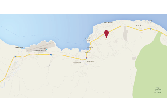
The residence “The Green Hills Village” will be built between the cities of Sosua and Cabarete. Sosúa is a municipality of the Dominican Republic with the resident count of 45.000, situated in the province of Puerto Plata. In addition to the capital, it entails two other municipal districts of Cabarete and Sabana de Yásica. Sosua has everything you could ever want from a seaside city: crystal-clear water full of corals, perfect for snorkeling and diving; colored houses along the Sosua beach, which gives the character to this place, makes it vivid and different from usual beach resorts. In the past, this small enclave of the Dominican Republic has been the paradise of Jewish refugees, and, in fact, historical sites and synagogues offer a broad prospective of the identity of Sosua during the pre-war period.
The 23 villas will be built in the territory of 30.000 sqm. The structure will rise in a strategic position, in front of the prestigious International American School of Sosua (www.issosua.com), mostly attended by students of foreign families, 300 m away from the private clinic Centromedicocabarete (www.centromedicocabarete.com) and 500 m away from the new supermarket “Super Pola” of the La Sirena chain, offering a wide product range. The land plot, on which the residential complex will be built is situated in a reserved and secluded area, distant from public streets, access to which from the residence will be via a private street of 150 m. This position makes TGHV a place, completely isolated from the outside, which allows owners of the villas to maintain their respective privacy.